British Army call for UAS-deployed sensors to survey ground and rivers
The British Army require UAS-deployable sensor technologies to survey river data for land force mobility and crossings.
Army Technology
75
4 min read
0 views
An industry competition has opened with the aim of reducing risk to personnel using uncrewed and rapid multi site survey.
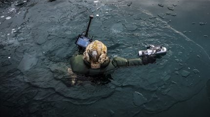
Royal Marine uses a sub-surface Rapid Beach Profiling System to survey the seabed under the icy water of a Norwegian Fjord, 25 February 2026. Credit: Crown copyright / UK Ministry of Defence.
UK Defence Innovation has launched an industry competition on behalf of the British Army
Tenders will demonstrate sensor tech to survey river data to enable land force mobility
With daily breakthroughs in uncrewed systems, it is hoped the competition will deliver greater capabilities than the last endevaour in 2021
Agencies within the UK Ministry of Defence have launched an industry competition to deliver novel sensor technologies, deployed from uncrewed aerial systems (UAS), allowing the British Army to assess the battlespace.
In doing so, the Government aim to reduce the risk to personnel tasked with surveying sites in person.
Discover B2B Marketing That Performs
Combine business intelligence and editorial excellence to reach engaged professionals across 36 leading media platforms.
Find out more
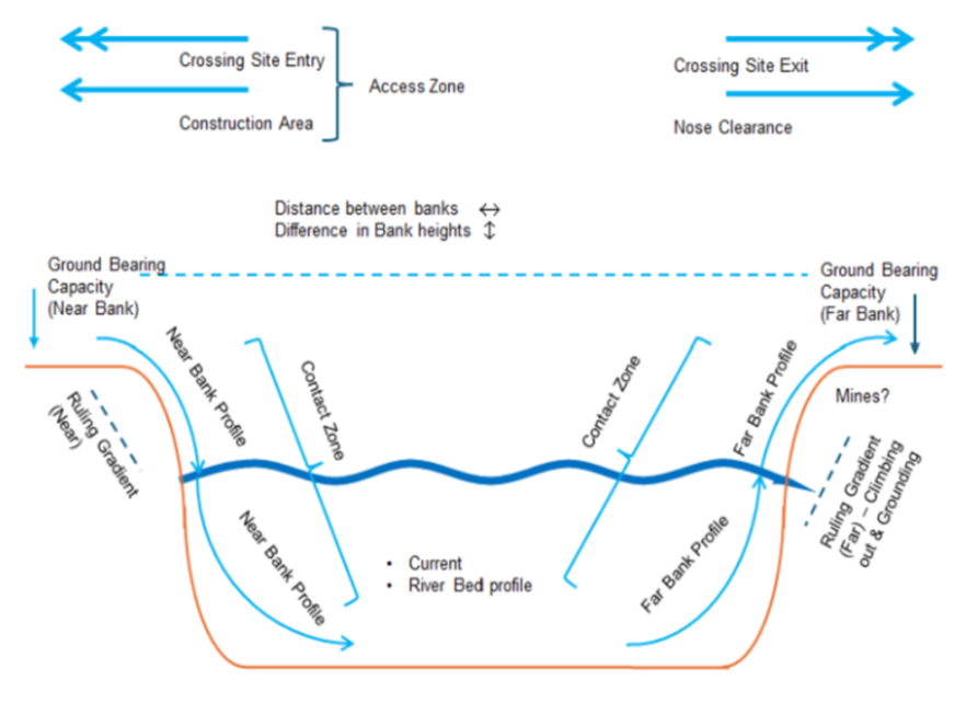
The competition specifically addresses two areas: the ability to measure ground bearing capacity and underwater river profiling.
Historically, this so-called “wet gap” has always posed challenges to the pace of land force mobility and logistics. But it is hoped, given recent technological advancements in autonomy, that the defence industry may enable the Army to travel faster and overcome the human risk to conventional surveying.
In fact, the competition requires that operators conduct the mission at a range of ~3-5km for the final deployment.
“Increasing the pace, stealth and number of viable crossing sites will increase operational agility and obfuscate tactical intent,” read the competition document.
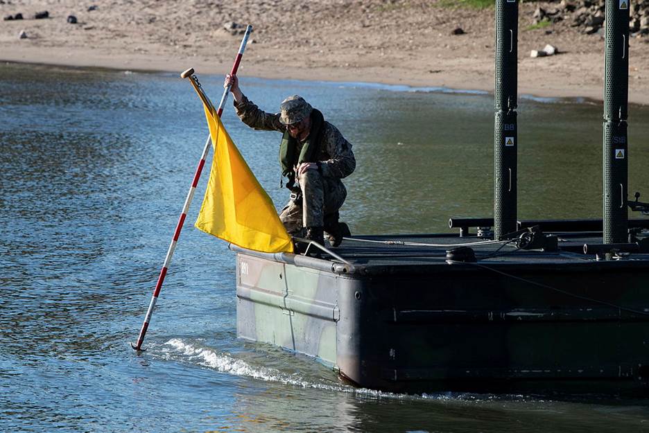
Operators of safety boats are measuring the depth of the banks of the River Rhine, 28 June 2025. Credit: Crown copyright / UK Ministry of Defence.
Each tender must deliver a demonstrable capability at technology readiness level six.
No more than £2m ($2.7m) will be made available for the competition, according to the notice issued on 6 May. UK Defence Innovation expects to fund three to four proposals across both challenges for a contract period of up to 15 months with plans to begin in October.
The submission deadline is scheduled to close midday on 16 June 2026.
Royal Engineer reconnaissance teams are tasked with assessing whether the ground and riverine environments are suitable for the safe passage of vehicles and whether specialist gap‑crossing equipment is required for the force.
Currently, measurements are taken in person.
Lessons from 2021 trials
An earlier competition took place in 2021 led by the Defence and Security Accelerator.
The competition demonstrated the potential for remote and autonomous systems in assessing the wet gap. However, each single uncrewed platform was limited in coverage, mobility and autonomy to deliver a full high fidelity wet gap survey.
Cross section of a wet gap annotated with measurement requirements. Credit: UK Defence Innovation.
In the 2021 competition, Nordic Unmanned was able to ascertain the water depth and flow speed using its ball-shaped WaFlow instrument but failed to demonstrate ground-measuring capabilities.
Ultimately, the trials exposed the penetration limits of bathymetric LiDAR in turbid conditions and revealed a need for robust UAS-deployable sensors to estimate ground bearing capacity across different sites.
Daily breakthroughs
A lot has changed in warfare since then. Recent conflict trends indicate a growing demand for uncrewed systems and intelligence, surveillance and reconnassance (ISR) capabilities.
In Ukraine, it is said that the fast-moving UAS sector – demonstrated by first-person view drones and fibre optic controlled systems – is changing on a daily basis.
In this backdrop, the data analytics firm GlobalData found that the emergence of novel technologies such as AI, LiDAR, and computer imaging are major drivers for investment in the remote sensing value chain.
The consultancy points to the growing integration of sonars, radars, and optronics on both civilian and military uncrewed vehicles, which are seeing increased use for hydrographic surveying, asset monitoring, environmental conservation, and even commercial shipping operations.
The Ministry of Defence likewise emphasised the need for modular, platform agnostic sensor packages that can be rapidly remounted when platforms fail or when missions require only part of the full survey.